05. Ballinrooaun Ringfort

Ballinrooaun Ringfort
Extract from the History of Moylough-Mountbellew, page 146, by John A.Claffey, M.A.,Ph.D.
Co-ordinates: 344543. National Grid: M594443.
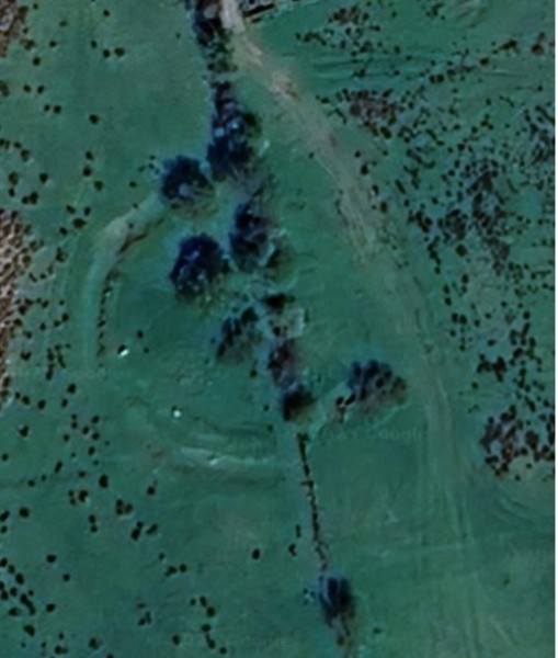
Situated on grazing land with a good view in all directions, the site consists of the remains of a roughly circular bivallate ring-fort. The external bank and fosse in the western quadrant are totally destroyed while the internal bank survives as a low mound. From N through E to S both internal and external banks and fosse are in relatively good condition. Much of the material of the surviving banks is composed largely of stone. A modern stone wall runs NE to SW through the site and this serves as a maring wall between two farms. There is rock outcrop in the S of the interior. It is probable that the surrounding land also had rock outcrop originally.
The internal diameter is 32 metres, width of external bank 2.10 metres, external height of same l0 cm to 20 cm, but in general this has slipped to the level of the field. The internal height of the external bank is 55 cm, width of ditch 1.60 metres, height of inside bank from bottom of fosse 80 cm approximately, internal height of inside bank 20 cm approximately. The banks are 3 metres from crest to crest.
The interior is rough and uneven with a scattering of hawthorn trees. In the S of the interior there is a patch of rock outcrop, while to the N is a collapsed souterrain surviving as an elongated hollow 6.40 m X 3.50 m.
No Comments
Add a comment about this page