10. Derryglassaun Ringfort

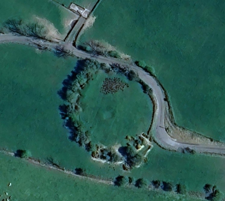
Derryglassaun Ringfort.
Extract from the History of Moylough-Mountbellew, page 151 by John A.Claffey, M.A.,Ph.D.
Co-ordinates: 339251. National Grid: M596412.
Situated on a slight rise in good grazing land with good views to the north, west and south. It overlooks bogland to the south while Knockroe is the predominant feature to the west. The site consists of a bivallate ring-fort which has been disturbed by a road running along the line of the external bank from north-east to south. Here the external bank has been replaced by a modern field wall though part of the bank is still visible outside the wall. From south through west to north the external and internal banks become clearly visible again, except for a segment of the external bank to the west which has been removed. The bank material is composed largely of earth. At the north-west the outer bank protrudes at an angle. Due to overgrowth it is difficult to determine whether or not this is interference with the original bank. The gap at north may be an original feature.
The interior is undulating. At its centre a large roughly circular depression may be a collapsed souterrain. This measures 5.30 metres on its longest axis which is roughly E/W.
Dimensions: External bank at N. 1.80 metres wide, c. 80 cm high on outer face, 1 metre high on inside from bottom of fosse. Fosse 2 metres wide. Internal bank at N. 4 metres wide, c. 1.80 metres high from bottom of fosse, c. 50 cm high on inside. Internal diameter 42 metres.
No Comments
Add a comment about this page