16. Kavanagh's Bridge.

Kavanagh’s Bridge.
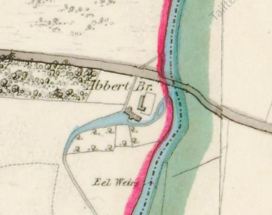
Kavanagh’s Bridge, which transverses the Abbert River joining the townlands of Gilkagh and Abbert Demesne and also the civil parishes of Moylough and Abbeyknockmoy, takes its name from the Kavanagh family who, while residing in Abbert Demesne, were land tenants in Gilkagh also – about 42 acres. In Griffiths Valuation of the 1850s Thomas Kavanagh operated a corn mill, while the property also consisted of a house, a cottier’s house, out-offices and 57 acres of land in Abbert Demesne. He had also sub-let another house, out-offices and five acres of land to his tenant Honoria Connolly. Upon the death of Thomas, in the late 1850s, the mill ceased to operate but his son Michael, and his wife Mary, continue to reside there in a farming capacity.
Water from the river was diverted upstream from the bridge to power the watermill before rejoining the main river again immediately prior to flowing beneath the bridge. The first ordnance survey map of the 1830s records the presence of an ell weir in this vicinity. fish weir which is an obstruction placed wholly or partially across a river, to direct the passage of, or trap fish. This weir was likely used to trap fish such as salmon as they attempt to swim upstream to breed in a river, or eels as they migrate downstream. Weirs were traditionally built from wood or stones.
This bridge itself if of limestone dating from the late 1700s, The contrast between the dressed limestone voussoirs and random rubble parapet gives the bridge a very pleasant appearance in the rural setting. This seven-arch limestone road bridge has round arches with dressed limestone voussoirs and with random rubble to spandrels and walls. Triangular ashlar cutwaters with triangular concrete plinths supporting pipe work to north-west elevation. Random rubble parapets with half-round rubble copings and random rubble limestone walls lead up to bridge.
The river at this point flows in a northerly direction. Further up stream Abbert bridge is located used primarily to access the upland bog at Abbert Demesne, while down stream is a bridge leading from the townland of Abbert Demesne to Cloonkeen. Early ordnance survey maps show this as being a wooden structure.
No Comments
Add a comment about this page