25. Turlough at Esker.

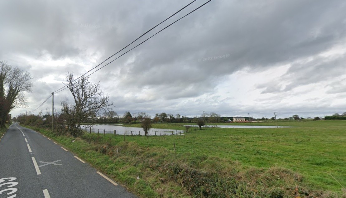
A turlough, or turlach, is a type of disappearing lake found mostly in limestone areas of Ireland, and particularly west of the River Shannon. The name comes from the Irish “tuar”, meaning dry, with the suffix “lach”,meaning a place. The “lach” suffix is often mistakenly spelled and/or thought to refer to the word “loch”, the Irish, Scottish Gaelic and Scots word for lake. They are found in Irish karst or exposed limestone areas.
Such a feature is located at the southern region of Esker townland and nestles between the roadway leading from Garbally cross to Skehanagh and the main Monivea to Menlough road and at high water levels it often renders the latter impassable to regular traffic. Its characteristics are consistent with those normally associated with turloughs across the region with regard to flooding, dry periods, underground flow, plant and wildlife, vegetation and drainage.
A drain leads from this turlough, on the western edge of the Menlough to Monivea road, and enters a tributary of the Killaclogher River at Drehidaunabale (ref: O.S. map 1838) in Carrowmore townland. Its purpose is to alleviate excessive flooding to nearby roadways. During the redevelopment of Skehana Community Centre, in the 1980s, a section of this drain, measuring 100 metres, was enclosed with stone sidewalls, a concrete cover complete with maintenance access lids, for the safety of patrons using the newly extended car park.
Local farmers used this feature primarily as a source of drinking water for animals for centuries and possibly other uses also such as sheep washing prior to shearing. An access opening, with gate, is still evident on the Garbally to Skehanagh roadway. With the installation of the Menlough-Skehana Group Water Scheme, during the 1970s, these practices ceased to be availed of.
No Comments
Add a comment about this page